
Support the site! Safe internet use begins with a trusted VPN provider. PrivateInternetAccess (PIA) has endpoints in many countries and a number of regions in the US. With clients for Windows, Mac, Android and iOS, PIA is a great VPN! Browse the Internet anonymously like I do, with PIA
Want to learn more? Watch the Youtube video, then buy PIA.
Since it was Saturday, we saw many more cyclists, either individually or in teams, making their way down the road between Salzburg (we’re five minutes from the city limit) and Berchtesgaden. The weather today was beautiful.
Today we were able to get an earlier start and, though the parking was crowded by 10am, it was still possible to find a spot within sight of the entrance of Berchtesgaden National Park. The park is about a 20 minute drive from our hotel (which is just over the border in Austria).
There are several B&Bs near the entrance of the park if you want to stay overnight, along with the inevitable souvenir shops and some restaurants.
We’ve visited this park twice before. The park is celebrating its 40th anniversary this year as a National Park, but its historical roots go back much further than that. Situated in the lowermost right corner of Bavaria, it’s near the intersection of Germany and Austria
The first time we visited, we basically replicated what we did today, taking the boat to its furthermost point on the Königssee (Salet) and walking (20 minutes) to visit the Obersee (Ober = above , see = lake), then catching the boat from Salet to St. Bartholomá and returning to Schönau where we started. The second time we visited, we didn’t take the boats but instead hiked up along the left side of the lake from Schönau.
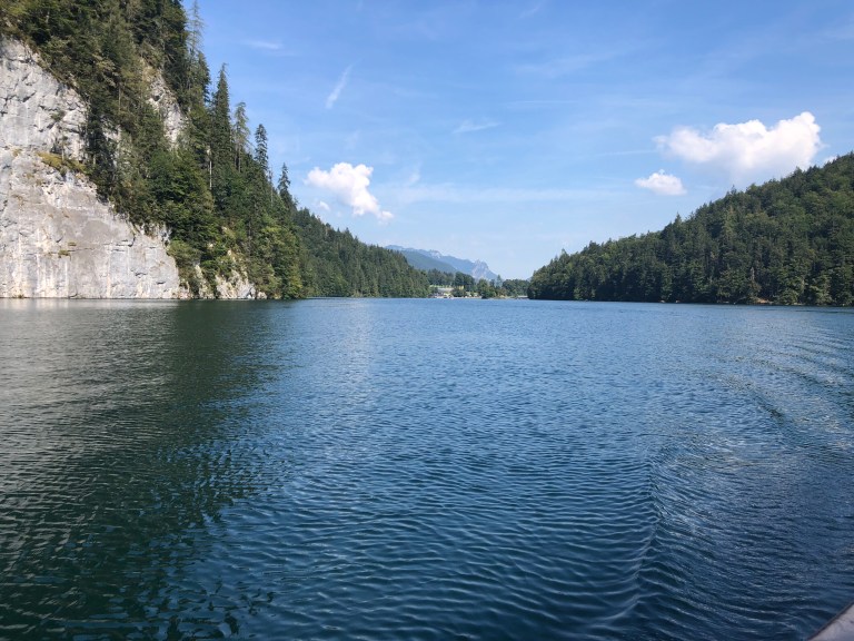
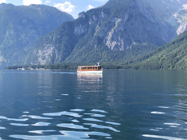
The main lake , the Königsee (“König = “King” , see =”lake) is 8 km (nearly 5 miles) long, about a mile wide at its widest and has a maximum depth of 200m (650 feet). The waters of the lake are perfectly clear (we’re told drinking water quality) but appear blue/ green, reflecting the colors of the sky and the mountains that surround it. The lake was formed during the last glacial ice age. The lake waters’ clarity is due to being fed by several waterfalls and by not allowing any type of polluting vessel or activity on the lake.
The area was never owned by a Bavarian King, but was a favorite hunting ground with a hunting lodge built for the ruling House of Wittelsbach. The lake’s name probably arose from its association with local nobles. In the twelfth century; the lake was formerly called Kunigsee.
Except at its outlet at the village of Königssee, the lake is similar to a fjord, being surrounded by the steeply-rising flanks of mountains up to 2,700 m (8,900 ft), including the Watzmann massif in the west (which rises up behind the Obersee). The tall evergreens on the mountains come down right to the edge of the lake, creating an impenetrable curtain into the forest.
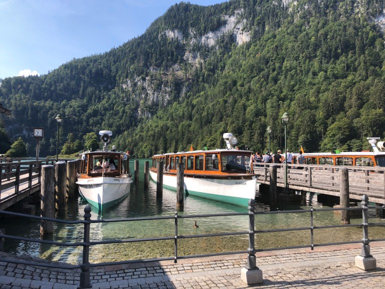
The lake is noted for its clear water and is advertised as the cleanest lake in Germany. For this reason, only electric-powered passenger ships,rowing, and pedal boats have been permitted on the lake since 1909. Passenger services along the length of the lake call at three points: Seelände (Schönau -the main base , St. Bartholomä, Salet (near where the Königsee ends). The longest tour takes two hours from Seelände to Salet. There were 18 electric boats operating today. The last boat back to the base of operations at Schönau is at 6:30pm. If you miss the last boat, they’ll come a get you, but it will cost €250 ($286). Don’t miss the boat.
The surrounding sheer rock walls of the mountains create an echo known for its clarity. On our boat tour, they upheld the tradition to stop and played a trumpet to demonstrate the echo.
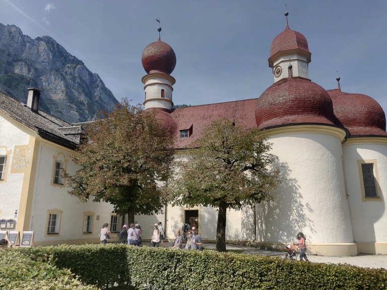
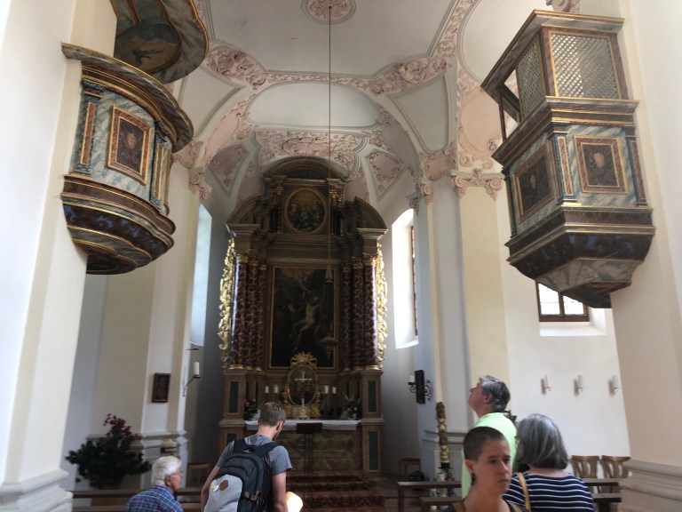
The first stop of the boat trip is at St. Bartholomä, a famous pilgrimage church with an inn nearby, located on a peninsula about halfway down the western lake shore. You can buy a boat ticket to only to St. Bartholomä, or the longer trip to Salet, which enables you to walk to see the Obersee.
South of the Königssee, separated by the Salet moraine (glacial debris), is the smaller Obersee lake with the 470 m (1,540 ft) high Röthbach waterfall. There are no boats that operate on the Obersee; any that do would have to be electric or row boats.
Because there is no lakeside path on the steep shore of the Königssee, St. Bartholomä and the southern edge can only be reached by boat, or via hiking trails up the surrounding mountains, except during harsh winters when the lake freezes over.
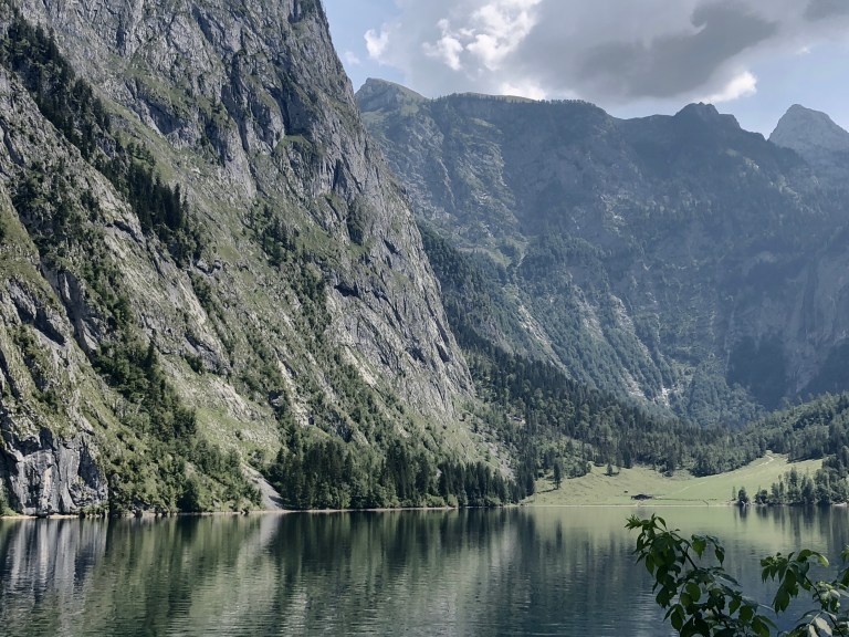
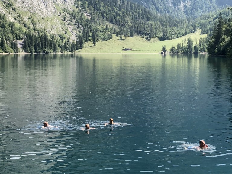
While there is no lakeside trail around the Konigsee, there is a trail carved into the mountain slope beginning at the Obersee. We hiked this trail for about half an hour before deciding that the half hour trek back was all we wanted, but it is possible to hike around the lake to the clearing you see at the far end. High up in the mountain above Obersee is the Rothbach waterfall. In a number of spots at Obersee there were people swimming.
Walking back the 20 minute trail from Obersee to Salet, we’ll catch a boat to St Bartholomá. With its isolation, St Bartholomá was an early pilgrimage site, with the first chapel being built in 1134.
We left St Bartholomá about 4:30, where there was by now a very long line waiting to board the next boat to Schonau.
Arriving back at Schönau at 5pm, I was surprised to see there was still a line to go out on the electric boats. We found that although the crowds were still large today, the only places it was really evident was when queuing for the boats or on the trail to/from Salet (to see the Obersee).
Tomorrow we leave Berchtesgaden to return our car in Munich then take a train to the next destination.

4 thoughts on “Königssee in Berchtesgaden”