

A cool front came into the valley overnight, bringing the temperature down 25 degrees to 51 degrees this morning, along with low clouds. The clouds hang low in the valley, coming down below the mountain peaks into the tree tops.
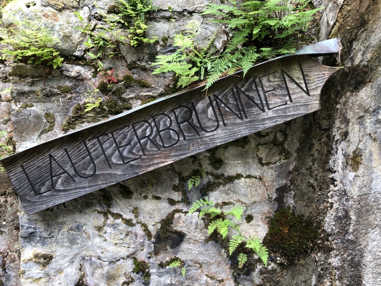
The early morning fog cleared up, but the clouds remain so going out to the Schilthorn isn’t going to be worthwhile, you’d be in the clouds. To reach the Schilthorn, you take the Lauterbrunnen-Murren cable car up to Murren (located on a plateau on one side of the valley) , then take the train across to the Schilthorn, but that’s all for naught if you can’t see anything, and it’s the same for going up to the Mannlichen or the Jungfrau. So we elected to take a hike alongside the Lütschine River which runs through Lauterbrunnen.
We’ve hiked alongside the Lütschine going out the Lauterbrunnen valley one direction on an earlier visit, so this time we went the opposite direction, towards Zweilütschine, where the Weisse (White) Zweilütschine Lütschine and the Schwarze (Black) Lütschine rivers meet. (Zwei=Two Lütschines) is where we changed trains at one point in the past when we visited Grindelwald. We won’t go as far as Zweilütschine today, but probably 30 minutes out.
We started our hike near the train station in Lauterbrunnen , taking a steep slope down to the river,
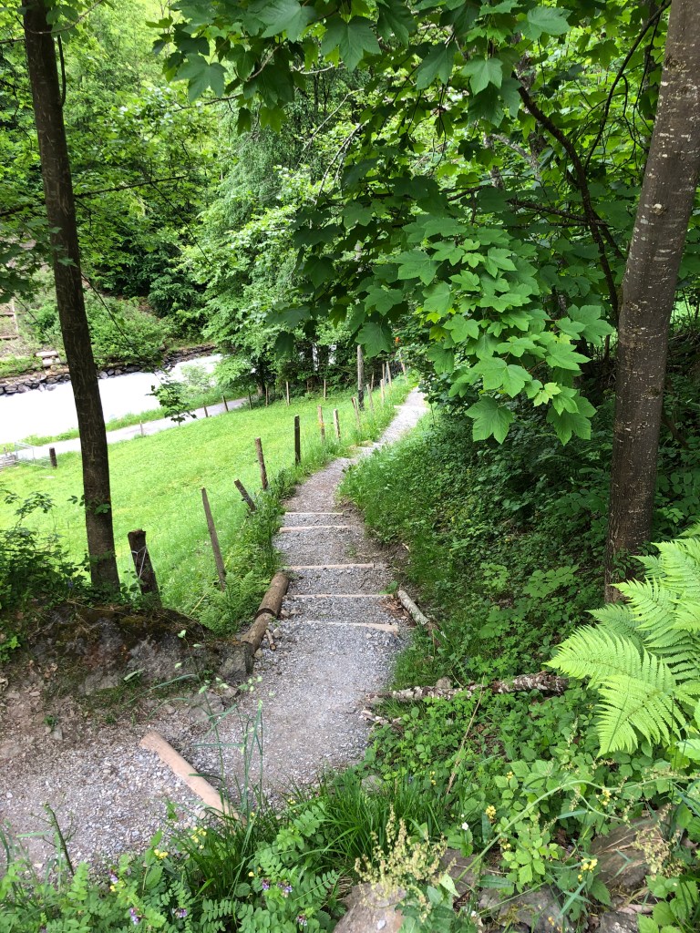
but once down, the path flattened out.
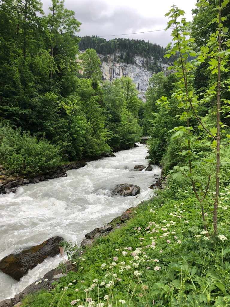
Though not particularly wide, the river is roaring past, colored a chalky white from the material its carrying as it rushes down from the mountains.
It’s a well defined hard packed path and at one point, a mountain biker sweeps past us going towards Lauterbrunnen.
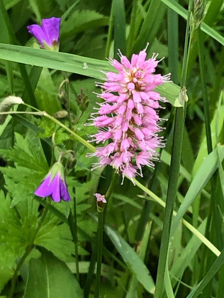
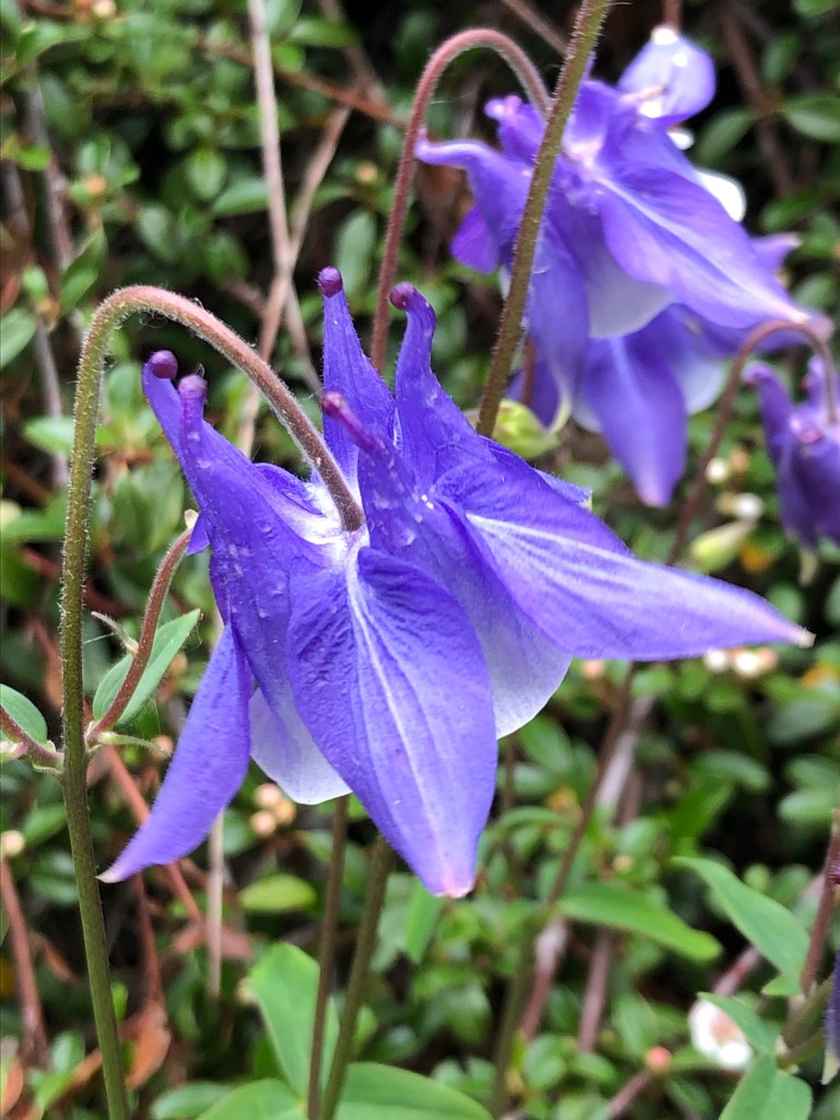
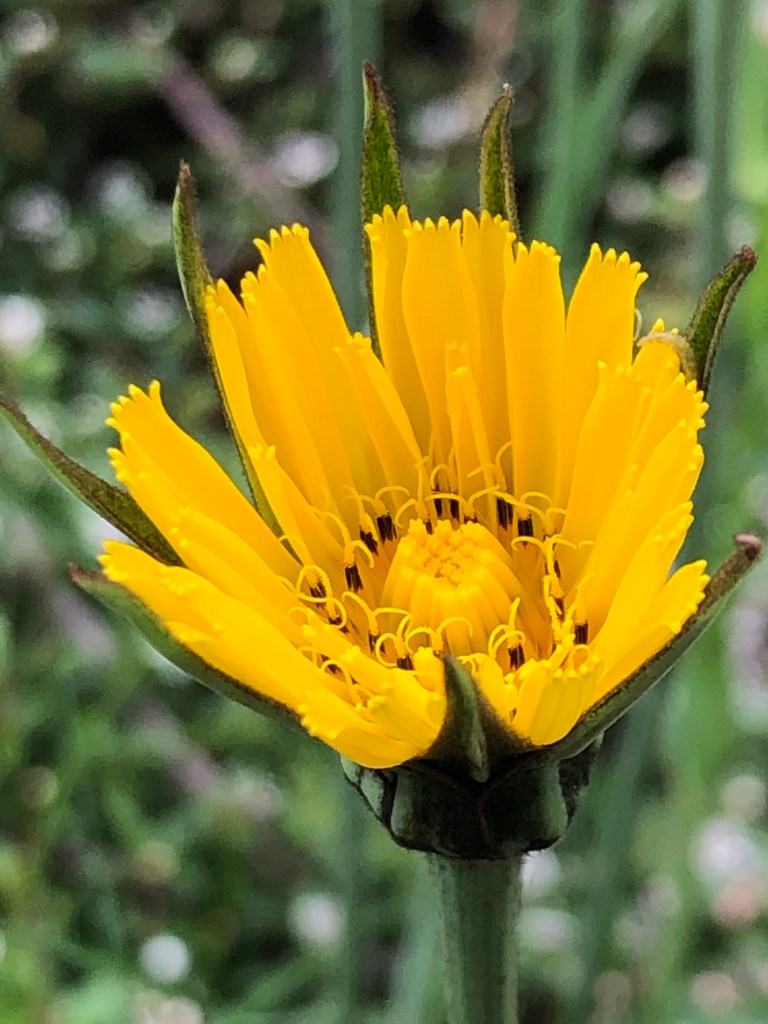
There are a lot of wildflowers on our side of the river.
Across the river, there is no path, just the dense forest that slopes up to the mountains. In some places, there are high meadows where you can see a summer barn.
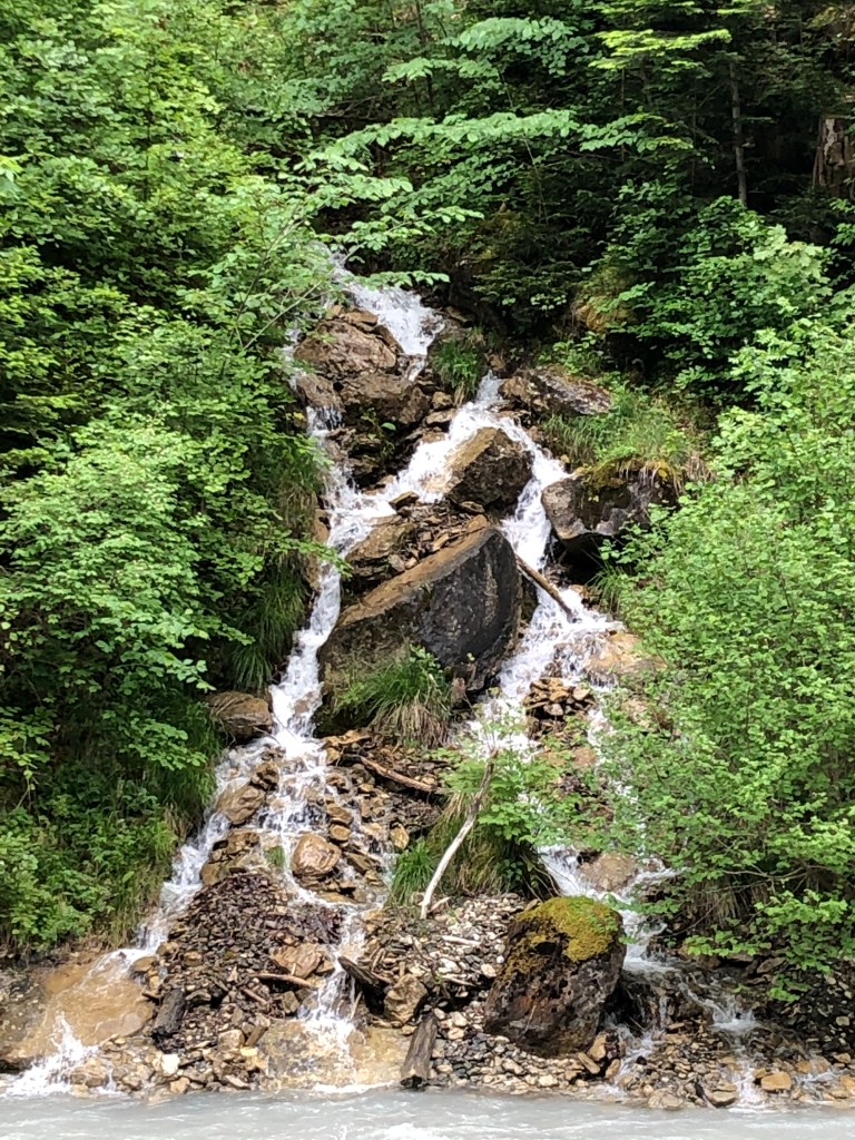
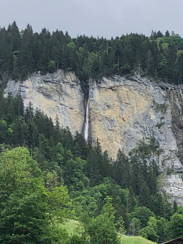
The riverbed has some large boulders that were washed down by the fast moving river at one point. Across the river, a small waterfall comes down the slopes.
There is a footbridge across the river
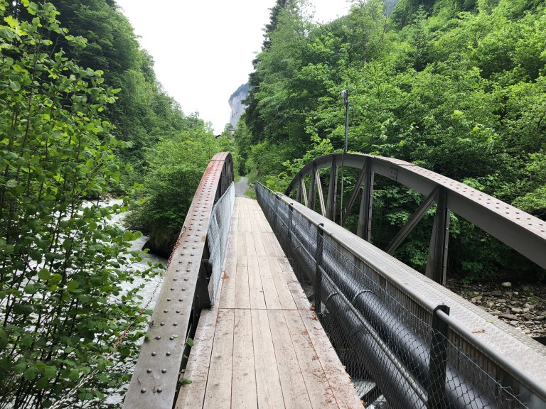
eventually taking us towards some structures built on what is now the far side of the river (as the near side is too narrow). The signage appears to indicate they were built by the railroad, which runs nearby and contains electrical equipment.
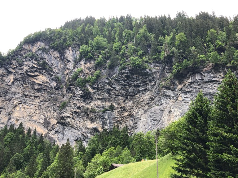
On the mountainside below you can see the extreme uplifting and faulting of the rock in the formation of the mountains, in some places looking like the rock was twisted. This valley was formed by glacial action, thousands of years ago.
We decide that we don’t want to walk as far as Zweilütschine and turn to go back to Lauterbrunnen.
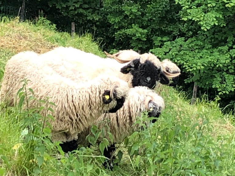
Closer to the rail station, we paused to look at the view and were joined by some sheep, grazing nearby. I think if there had not been a fence, they would have come right up to us. The goats weren’t so sure about us and kept their distance.
Support the site! Safe internet use begins with a trusted VPN provider. PrivateInternetAccess (PIA) has endpoints in many countries and a number of regions in the US. With clients for Windows, Mac, Android and iOS, PIA is a great VPN! Browse the Internet anonymously like I do, with PIA
Want to learn more? Watch the Youtube video, then buy PIA.
