Support the site! Safe internet use begins with a trusted VPN provider. PrivateInternetAccess (PIA) has endpoints in many countries and a number of regions in the US. With clients for Windows, Mac, Android and iOS, PIA is a great VPN! Browse the Internet anonymously like I do, with PIA
Want to learn more? Watch the Youtube video, then buy PIA.
Our journey today took us from Zurich to Interlaken to Lauterbrunnen. It’s about a 2 hour train trip from Zurich to Interlaken with a change of trains in Switzerland’s capitol, Bern.
If you’re prepared for it, the time to change trains in Bern isn’t a problem. The scheduled arrival/departure gap is 8 minutes. Fortunately, the tracks weren’t far apart and we’ve made this changeover before. And, our inbound train was on time.
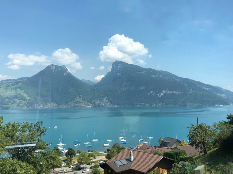
On the way out of Interlaken (Inter = “between” laken= “lakes”) the train takes you past Thunsee and Brienzersee, two alpine glacial lakes. They’re very large lakes and each are summer resort areas.
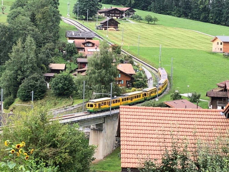
The trip from Bern to Interlaken is but an hour. The rail reservation from Zurich to Interlaken is on SwissRail, but once in Interlaken, to go up further in the Alps, you have to buy a separate ticket as the Berner Oberland Bahn (BOB) is a private rail system, not part of SwissRail or Eurail. Even as busy a time as it is during the season, we didn’t have to wait long to buy one-way tickets. You should only buy round trip tickets if you are making the trip on the same day.
It’s less than an hour between trains, so we had time to pick up a few things at the Co-Op (regional grocer/retailer). Lauterbrunnen itself has one small (smaller than my house) grocery store. We left Zurich at 11 am and we’re in Lauterbrunnen by 3;00.
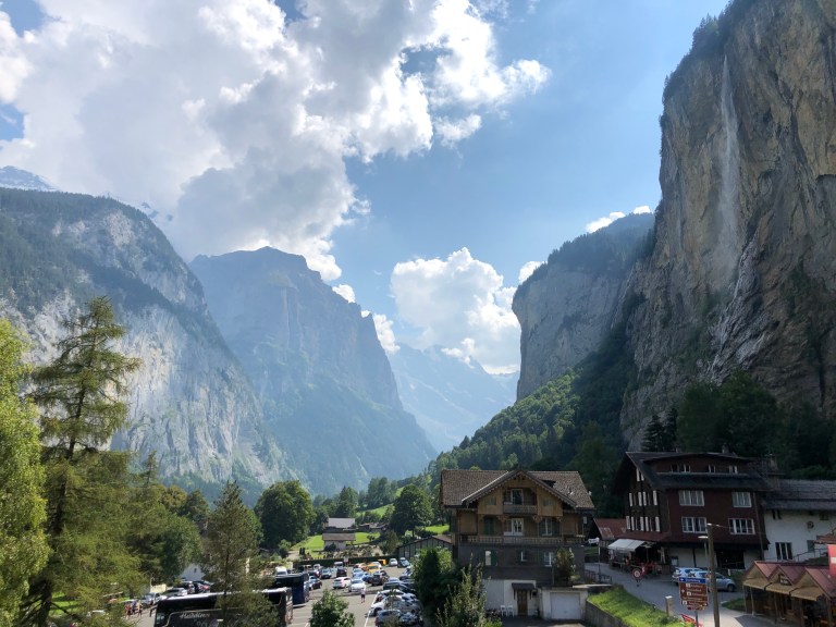
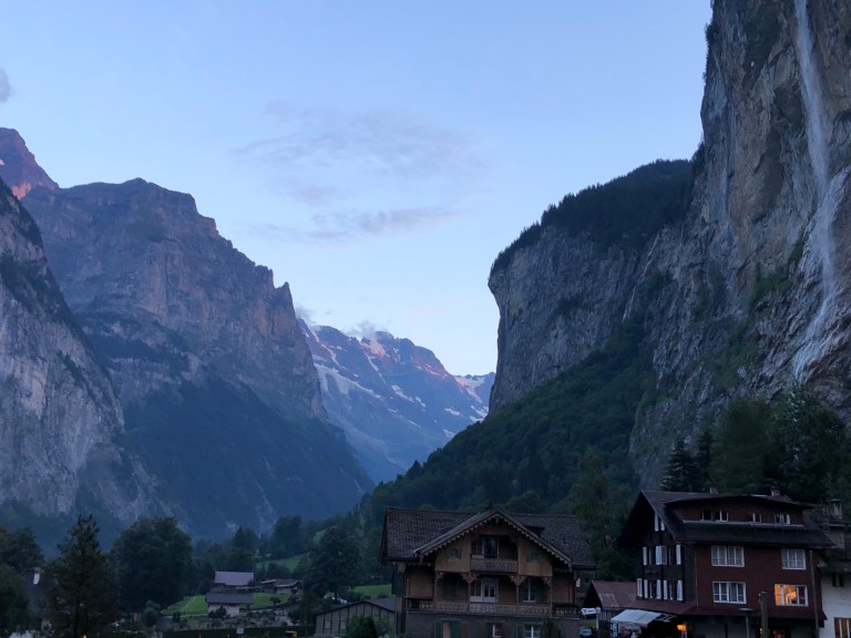
Lauterbrunnen is a small village in a beautiful valley. Literally translated, (Lauter = “nothing but” Brunnen= “fountains or falls”) with 72 waterfalls in the valley , it’s easy to spot them almost wherever you look. Looking out our window when we arrived, we saw two hang gliders. There are other villages higher up above us on the surrounding mountains. These are reachable primarily by train or cable lift. There are probably roads up to those two villages, but they’d have to be pretty steep. You’ll frequently hear the sound of helicopters, because in some areas that is the only means of lifting construction materials in or out of the area.
The Jungfrau is the tallest mountain in this area and has the highest (in elevation) rail station in Europe. We’ve made the trip up to the Jungfrau twice, which requires a cog wheel train due to the incline of the track as it goes from Lauterbrunnen (2,631′) to Wengen (4180′) to Kleine Scheidegg (6,762′) to the Jungfrau (11,332′). There is a permanent glacier at this elevation and the entrance into the rail station takes you through a tunnel carved into the ice of the glacier.
Here in Lauterbrunnen, this is our view from our hotel room The waterfall at the right is called The Staubbach Falls.
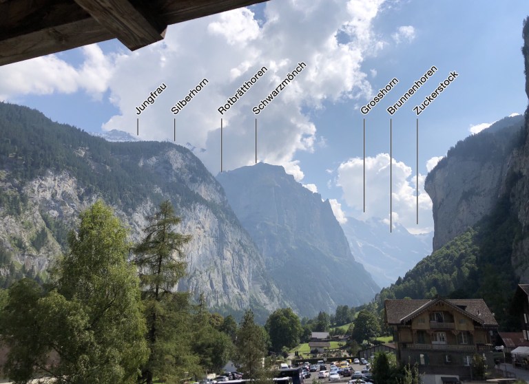
If you look at the photo below, you can see the names of some of the peaks.
Though a small village, Lautebrunnen is the center for a lot of outdoor activities: Parasailing, cycling, hiking, rafting, camping (there’s a permanent campground a short walk from our hotel).
After checking in, we took a short walk down the road (there’s only one main road through the center of town) back towards the train station and Co-Op and got caught in a brief afternoon thundershower. While it was a bit warm earlier, the rain really cooled things off (no A/C here). The rain passed and the skies cleared as the evening set in and out view of the mountains at 8:30pm is
A brief video.
